


What Is Ghaziabad Master Plan 2031?
Ghaziabad Master Plan 2031 is a GIS‑based blueprint for planned growth of Ghaziabad, Loni and Modinagar/Muradnagar, covering about 32,000–33,500 hectares and guiding how land will be used, how people will move, and where future real estate will come up. It focuses on transit‑oriented development (TOD), mixed‑use zones, special development areas and more green space, making Ghaziabad a self‑sustaining hub rather than just a spill‑over market of Delhi.
The Ghaziabad Master Plan 2031 is an integrated, GIS‑based land‑use plan prepared by the Ghaziabad Development Authority (GDA) for Ghaziabad city along with Loni and Modinagar/Muradnagar regions. It replaces and expands the earlier 2021 plan, increasing the planned development area from about 25,099 hectares to around 32,017–33,543 hectares to match the city’s rapid growth.
The plan is designed to accommodate a projected population of nearly 48–65 lakh residents by 2031, depending on the sub‑area, by systematically allocating land for housing, industry, commerce, transport, recreation and public facilities. Because it is GIS‑based, all plots, roads, utilities and zoning regulations are mapped digitally, helping GDA control unauthorised layouts and guide infrastructure investment more efficiently.
Total Area and Population Projections
Different official and explanatory documents quote two closely related figures for the planned area: one mentions about 32,017.81 hectares of development area, while others refer to an integrated 33,543‑hectare region when Ghaziabad, Loni and Modinagar/Muradnagar are all considered together. In both cases, the new plan covers significantly more land than the earlier 2021 plan to ensure enough space for future expansion.
The population of the planning area is expected to rise to around 48 lakh by 2031, which is why the plan increases residential, mixed‑use and transit‑linked capacity. To handle this growth, the document emphasises vertical development (higher FAR) near major transport corridors, rather than endless horizontal sprawl.
Land Use Allocation: How the City Is Divided
Ghaziabad Master Plan 2031 defines a clear split of land across different uses so the city can grow in a balanced way. Approximate allocations include:
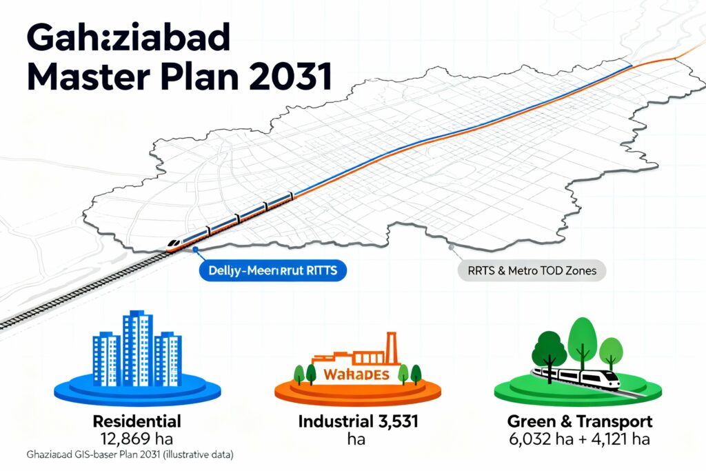
- Residential: about 12,869 hectares (around 39.8% of the total area) set aside for housing in various formats.
- Commercial: roughly 744 hectares for shopping centres, office spaces and mixed‑use commercial belts.
- Industrial: around 3,531 hectares for industrial estates, manufacturing units and warehousing.
- Mixed‑use: about 553 hectares, allowing combinations of residential, commercial and other activities in the same zone.
- Recreational/green: nearly 6,032 hectares for parks, open spaces, playfields and ecological buffers.
- Transport and related uses: about 4,121 hectares for roads, terminals, depots, rail corridors and other mobility infrastructure.
This land‑use pattern underlines three big priorities: giving sufficient land to housing, building strong industrial and commercial bases for employment, and reserving a meaningful share for green and recreational spaces.
Transit‑Oriented Development (TOD) and Connectivity
One of the most talked‑about features of Ghaziabad Master Plan 2031 is its strong focus on Transit‑Oriented Development. TOD zones are special areas along high‑capacity transit like the Delhi–Meerut RRTS line and Metro corridors where higher FAR and mixed‑use projects are allowed to encourage dense, walkable neighbourhoods around stations.
According to official data, about 4,261 hectares are earmarked as TOD zones around the RRTS corridor and roughly 637 hectares along Metro lines. In these TOD belts, land‑use rules allow a combination of residential, commercial and sometimes institutional or light industrial uses, making them ideal for high‑rise apartments, office towers, retail and co‑working spaces near stations.
Special Development Areas and New Growth Pockets
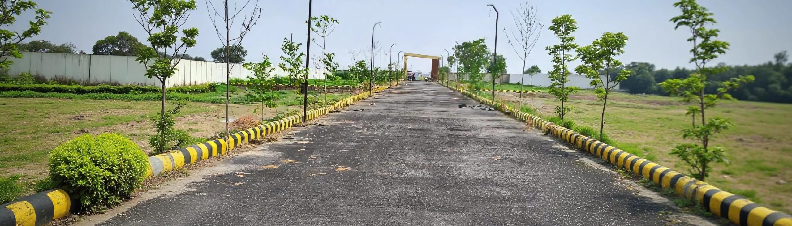
The plan also identifies Special Development Areas (SDAs) where GDA expects major new growth and therefore allows more flexible or intensive development. These SDAs are typically planned along expressways, around new transit nodes or in partially urbanised villages that will soon get city‑level infrastructure.
Examples mentioned across various summaries include areas around Guldhar, Duhai and the Eastern Peripheral Expressway, where industrial parks, logistics hubs and high‑density mixed‑use sectors are expected. For real estate investors and developers, these pockets can offer strong upside as infrastructure and demand catch up with the zoning potential.
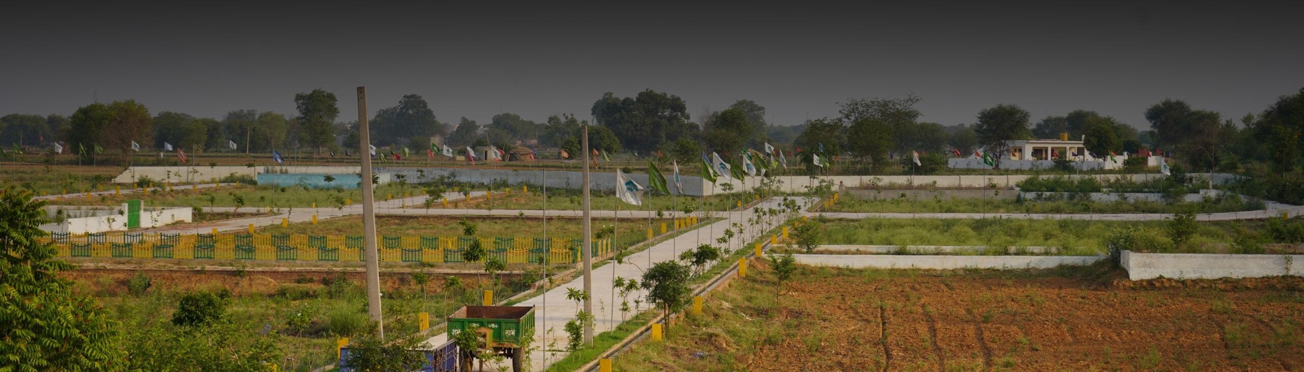
Residential Development: Opportunities for Homebuyers and Investors
With nearly 40% of the land earmarked as residential, Ghaziabad Master Plan 2031 aims to meet housing demand across income groups. The plan supports a mix of plotted developments, group housing societies, EWS/LIG housing and integrated townships spread across Ghaziabad city, Loni and Modinagar/Muradnagar.
Because FAR and allowed heights are higher around RRTS and Metro corridors, many future residential projects in TOD zones are expected to be mid‑ to high‑rise apartments with retail on the ground floors. For end‑users, this means better connectivity and services; for investors, these corridors can become rental‑yield hotspots as commuting time to Delhi, Noida and Meerut drops significantly.
Industrial, Logistics and Employment Hubs
The plan reserves more than 3,500 hectares for industrial use to maintain Ghaziabad’s role as an important manufacturing and logistics centre in NCR. Many of these industrial zones are aligned with expressways like the Delhi–Meerut Expressway and Eastern Peripheral Expressway, as well as near existing industrial estates.
There is also emphasis on logistics parks, warehousing and service industries that can benefit from Ghaziabad’s location between Delhi and the wider Uttar Pradesh hinterland. This industrial and logistics expansion is expected to generate large employment, which in turn supports demand for nearby housing, retail and social infrastructure.
Ghaziabad, Loni, Modinagar & Muradnagar: Integrated Approach
Instead of planning Ghaziabad city in isolation, Master Plan 2031 treats Ghaziabad, Loni and Modinagar/Muradnagar as one integrated region. This helps distribute growth more evenly, prevent over‑congestion in core city areas and upgrade neglected peri‑urban belts with planned infrastructure.
The integrated plan also rationalises road networks, green belts and public facilities across the whole region rather than duplicating them in each town. For example, some TOD zones, SDAs and industrial clusters are placed strategically so they can serve residents and businesses from multiple sub‑areas simultaneously.
Impact on Real Estate and Investment Hotspots
Ghaziabad Master Plan 2031 directly ties real estate prospects to connectivity and land‑use zoning. Corridors near RRTS stations (like Sahibabad, Ghaziabad, Guldhar, Duhai etc.) and Metro lines are being shaped into high‑density, mixed‑use pockets, which typically see faster appreciation and stronger rental demand.
At the same time, newly added development area around expressways and SDAs opens opportunities for plotted housing, affordable projects and logistics‑linked real estate at relatively lower entry prices. For agents and developers, understanding the exact TOD boundaries, SDA locations and sector‑wise land‑use is critical to choosing the right micro‑markets and product mix.